Thoughts on how Everett became a housing boomtown in the Boston area

SOLUTIONS

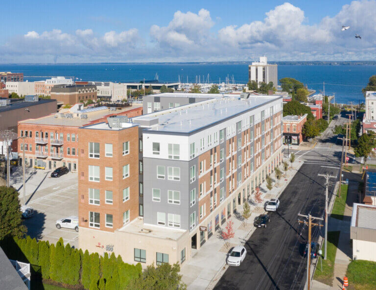
A Boston Globe article showed how Everett permitted housing at the fastest rate in Greater Boston, adding 16 percent more housing units between 2015 and 2021. Much of that growth took shape in the Commercial Triangle, a post-industrial area where CommunityScale’s Nels Nelson led the neighborhood planning process in 2019. This post reflects on how Everett became a housing boomtown, including the rezoning and the parking reforms, such as a Transportation Demand Management ordinance, that helped unlock so much new housing so quickly.

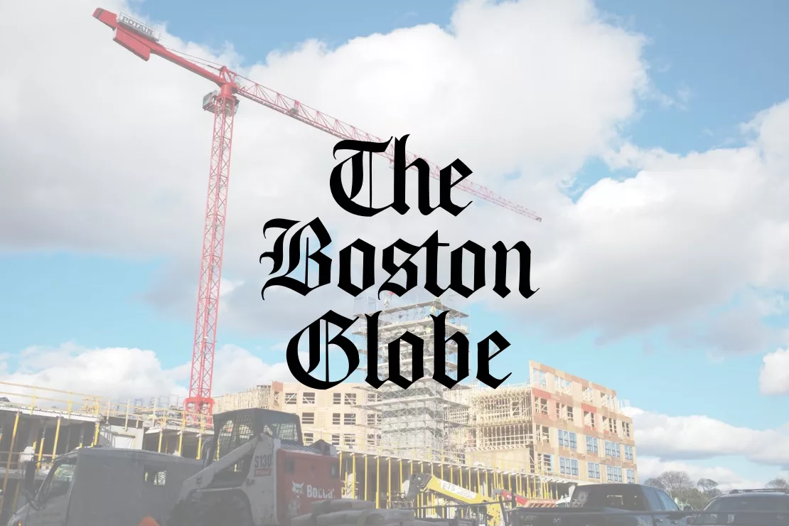
The Boston Globe masthead over a photograph of a large multifamily housing development under construction, with a red tower crane above wood-framed upper floors.

This February, the Boston Globe published an article How Everett became a housing boomtown in the Boston area that demonstrated how Everett has permitted housing units at the fastest rate in Greater Boston, adding 16% new housing units from 2015 to 2021.

The Boston Globe masthead over a photograph of a large multifamily housing development under construction, with a red tower crane above wood-framed upper floors.
How Everett became a housing boomtown in the Boston area

Much of this new housing is in the Commercial Triangle, a post-industrial area where I led the neighborhood planning process in 2019. I also helped the City reconsider how off-street parking is administered through a Transportation Demand Management Ordinance that allows developers to offset parking with contributions such as bicycle facilities.
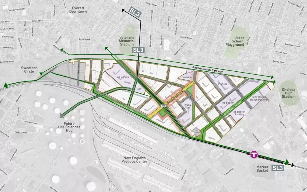
Plan drawing of the Commercial Triangle district in Everett, Massachusetts, showing proposed development parcels in lavender, a green street and open space network, the Silver Line SL3 bus route with stops, and surrounding landmarks including Sweetser Circle, Veterans Memorial Stadium and the future Life Sciences Hub.
Commercial Triangle Neighborhood Plan

Looking forward, CommunityScale and the City of Everett are engaged in rewriting the entire zoning ordinance. The recodification is meant to better align the code with the vision of a transit-oriented walkable and vibrant city, stop “zoning by variance”, and bring much of the city into conformity.

As shown below, there are several adopted neighborhood plans that will be considered during the rezoning, and that have already contributed to the housing boom as written about by the Globe.
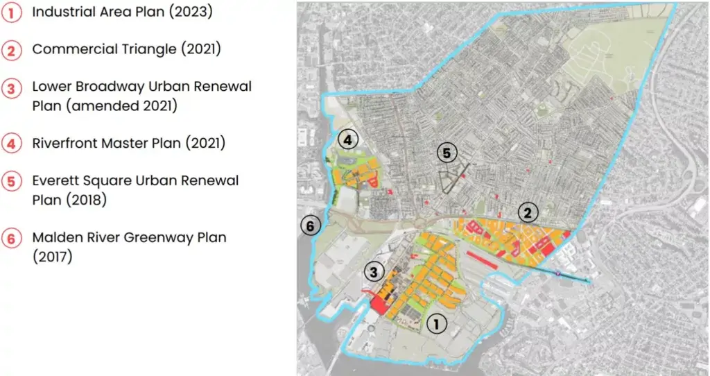
Aerial map of Everett, Massachusetts keyed to six numbered planning efforts: the Industrial Area Plan of 2023, Commercial Triangle of 2021, Lower Broadway Urban Renewal Plan amended 2021, Riverfront Master Plan of 2021, Everett Square Urban Renewal Plan of 2018 and Malden River Greenway Plan of 2017, with each study area highlighted within the city boundary.
Overview of Everett’s existing neighborhood plans

The City administration has taken a strong position to help address the region’s housing crisis, while also establishing policies that reduce car traffic, promote walkability, reduce carbon emissions, and redevelop polluted post-industrial land. We expect to continue to see great things from the City and are proud to be partners in the vision.

Table of contents page from the Everett Design Guidelines asking 'What aspects of design are regulated?', with an axonometric drawing of two mixed-use blocks around a green courtyard, annotated with the guideline sections: context, connections, site design and open space, complete streets, program, ground floors, massing, parking, amenity space, compact living, roofs and architectural details.
Excerpt of the Everett Design Regulations
About us

Our team, mission, and approach to housing and planning.

Learn more →
Clients

The cities, regions, and partners we work with.

Learn more →
Careers

Join the team — we are hiring planners, engineers, and analysts.

Learn more →
News